GeoBlacklight Winter Code 2018 & New Release 1.8
The GeoBlacklight Community Winter Code has resulted in a new release (1.8.0) that includes a new feature for index maps, bug fixes, and improved metadata documentation.
Developers from Stanford, Princeton, NYU, Cornell, and the University of Minnesota participated in a two-week GeoBlacklight Winter Code during January 2018. The developers completed work on enabling a new format for index maps, squashing several bugs, and an expansion to the GeoBlacklight Metadata 1.0 schema documentation. Progress was also made on the display of attribute table information and the development of a GeoBlacklight plugin that would enable harvesting thumbnail images from geospatial web services or IIIF image servers.
OpenIndexMaps
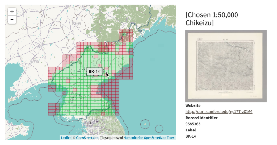
GeoBlacklight’s latest release includes a major new feature that enables OpenIndexMaps based on the GeoJSON format. This feature will display a spatial index in the map preview box that allows users to select an overlay object, such as a grid section. This will bring up a preview of the item’s basic metadata, a thumbnail image, and access links. See Configuring Index Maps for Use in GeoBlacklight for more information on how to add index maps to metadata records.
Check out this index map in EarthWorks from Stanford Libraries: